River Obstacles: crowdsourcing river fragmentation using a mobile app
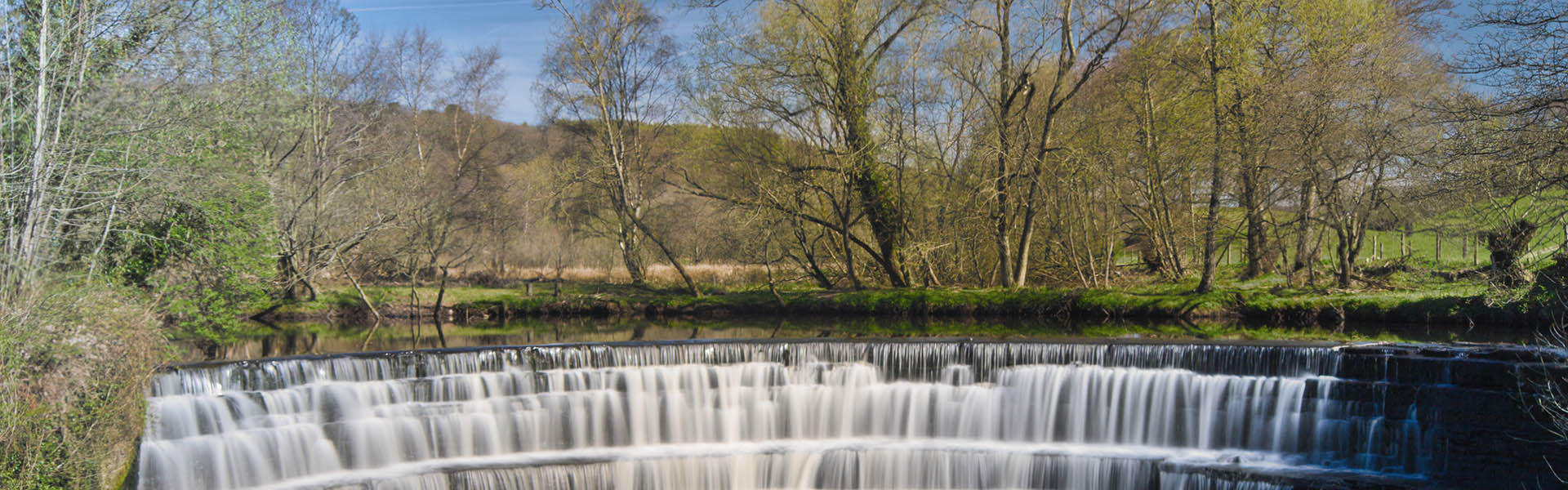
A human-made weir on a UK river. Image: River Obstacles
Flows of water in rivers and streams across the UK are diverted over, under, through and around many different obstacles. Some of these are formed naturally – for example waterfalls – whilst others are human-constructed, such as dams, sluices and weirs.
As we’ve discussed in a number of posts (here and here, for example), whilst such human-made obstacles can have societal benefits (such as hydropower generation), they often have negative ecological effects: fragmenting fish migration routes, causing bank erosion, changing habitats and altering water and sediment flows.
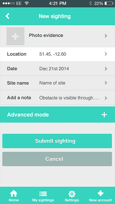 An innovative new smartphone app has recently been released to allow members of the public to log the location and type of river obstacles – both natural and human-made – in UK rivers. River Obstacles has been jointly developed by the Scottish Environment Protection Agency (SEPA), the Rivers and Fisheries Trust for Scotland (RAFTS), the Environment Agency (EA) and the Nature Locator team.
The free River Obstacles app allows river users such as anglers, canoeists and walkers to log the details and submit photographs of obstacles such as dams and weirs. The data from these ‘citizen hydrology’ submissions will help map obstacles in regions where there is currently very little information (such as in remote areas), or where obstacles have recently been built or damaged.
The crowdsourced data submitted through the app will allow environmental managers and policy makers to identify redundant human-made obstacles that can be removed from rivers, and prioritise improvements to other obstacles that will yield significant environmental improvements. Information on natural obstacles will also be used to determine the natural limits to movement for different species of fish.
Environmental data submitted by members of the public has been growing in popularity over the last five years or so in the ‘citizen science’ movement (see our interview with Helen Roy from the Centre for Ecology and Hydrology on the subject).
Public sourced information on the natural world – increasingly facilitated by advances in mobile technology – has a number of potential benefits: for example, creating data for areas where scientists may not have sampled and engaging members of the public with processes of environmental monitoring and management (see another, older post on the subject from back in 2010).
This is the first time we’ve seen this technology used to crowdsource hydrological data, making River Obstacles an innovative and interesting initiative. We’ll keep you updated with its results.
River Obstacles
Download for iPhone and Android


